Product overview
LUUCY – the interactive platform for spatial and real estate development
We have provided you with everything you need to start planning your spatial or real estate development projects: the topography of the Swiss landscape with all the buildings and the vegetation in 3D, building law principles, data from the official cadastral survey, maps and helpful tools. Everything digital, central and interactive.
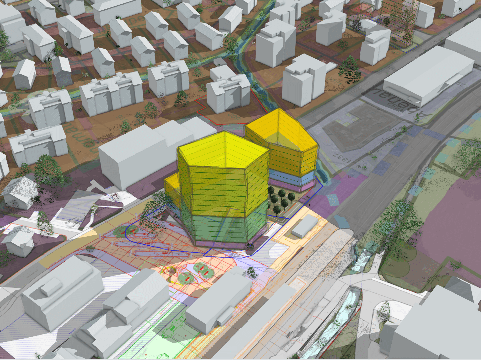
LUUCY offers simple tools to shape your ideas directly in the digital model of our settlement space.
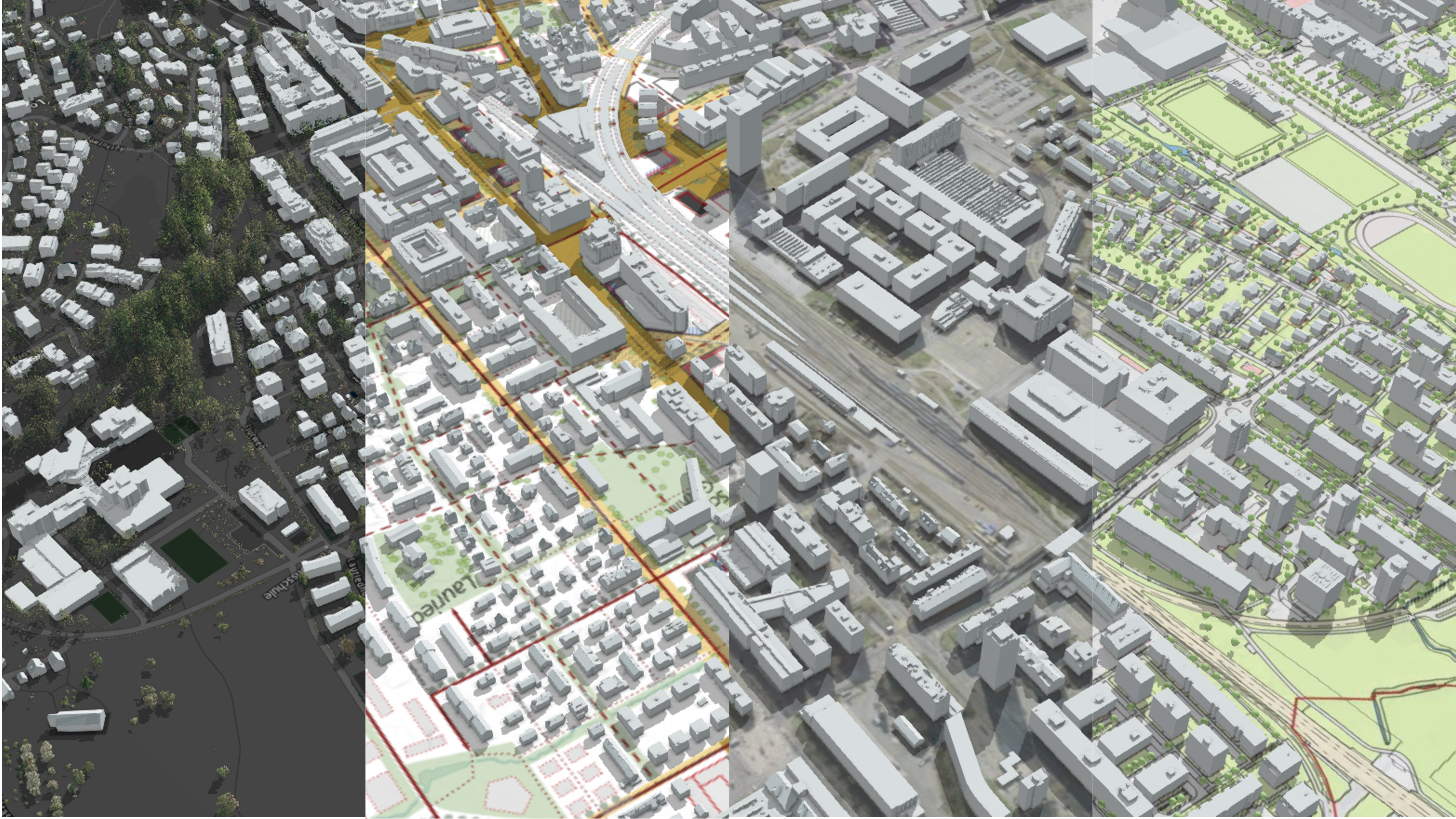
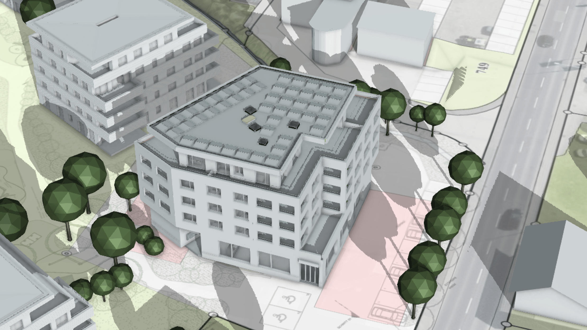
The core of LUUCY is the digital 3D twin of our built world with its buildings, topography, and vegetation – powerful and easily available on the web.
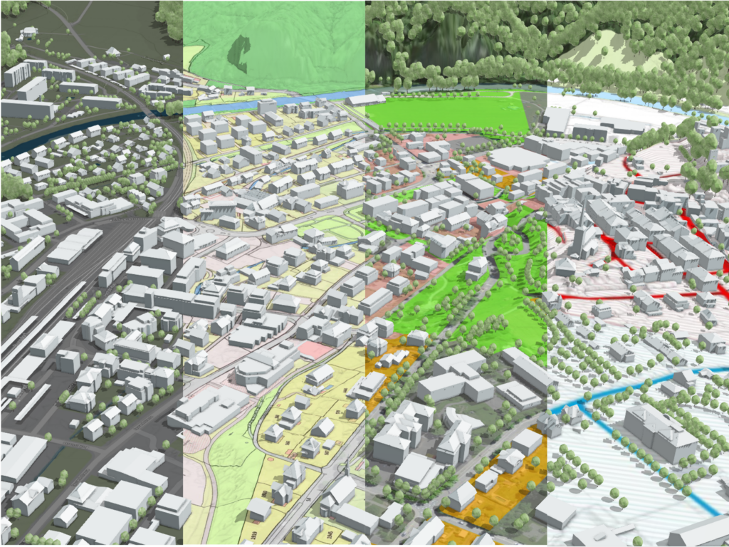
LUUCY offers you up-to-date geoinformation data from public sources throughout Switzerland.
You can order, overlap, and combine them according to your needs to gain valuable insights easily and quickly.
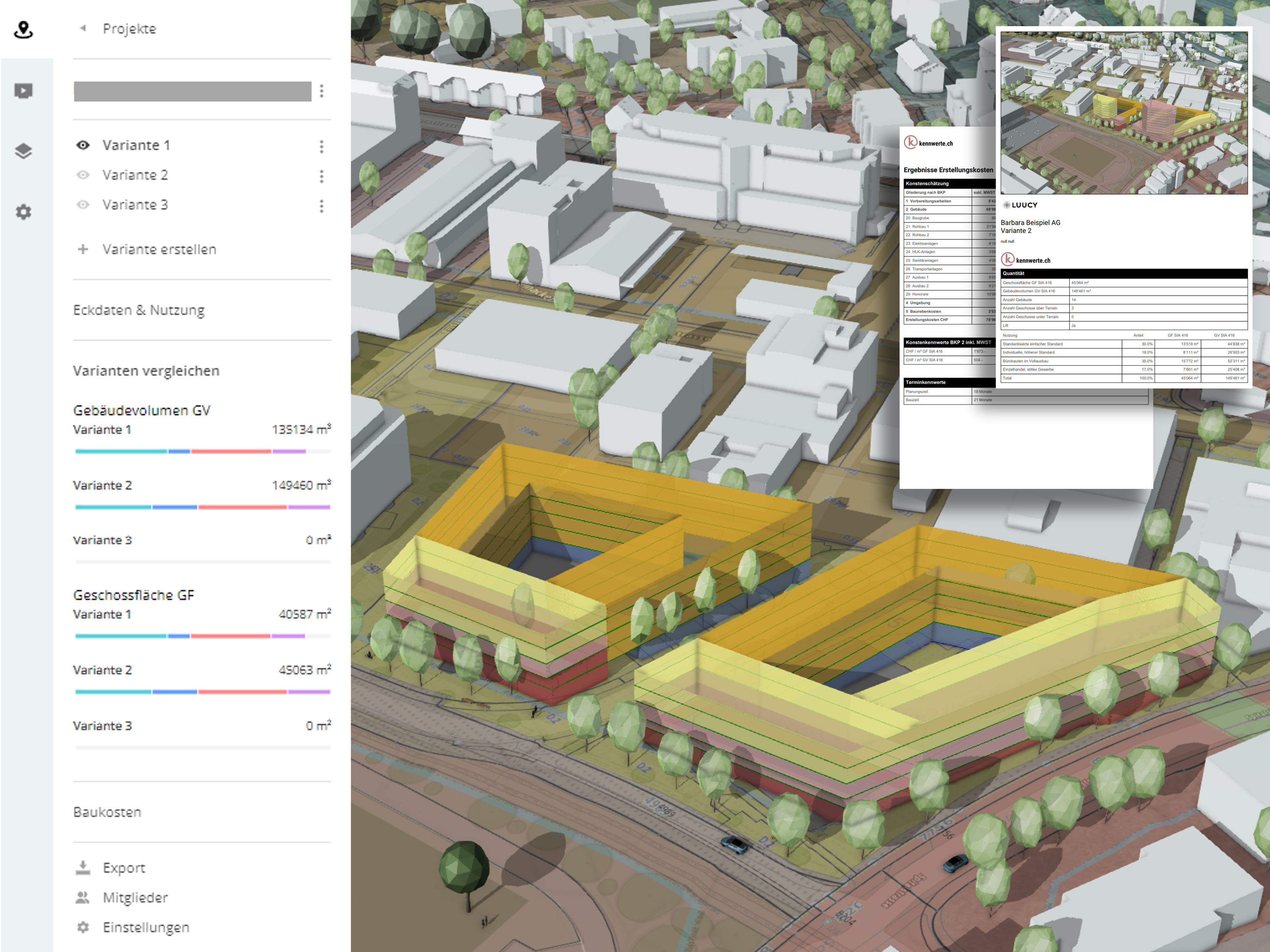
LUUCY offers evaluation tools that provide you with data and facts during the planning process.
Compare the economic potential of the drafted variants directly in LUUCY and create the basis for decision-making in a short period of time
basic functions
Learn how companies are using LUUCY

Interactive 3D twin incl. time control and shadows
Marketplace with many free datasets and apps
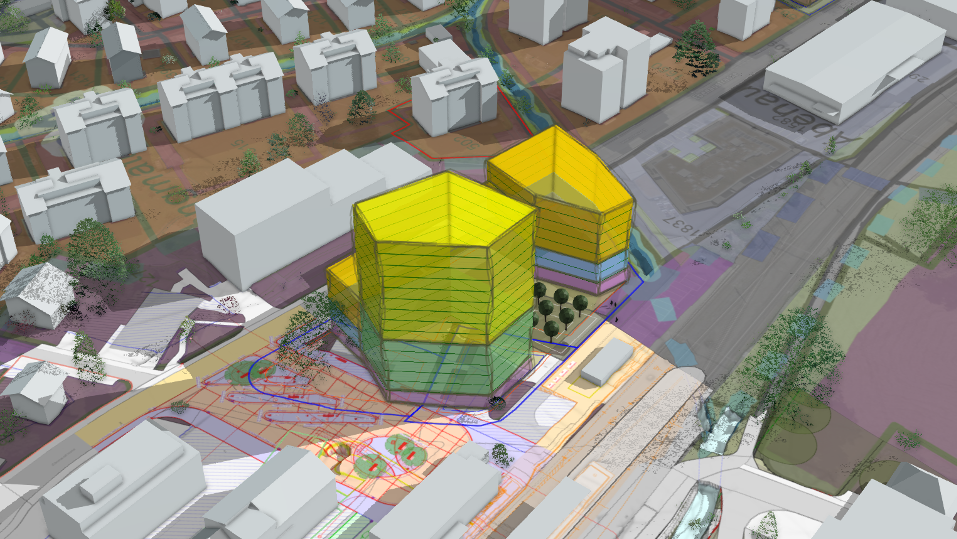
Projects with interactive modelling functions such as buildings, areas, markers, text and much more
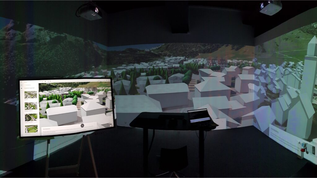
Presentations – explaining complex topics easily
Export and import of 2D and 3D data
basic data
All the data for you in one place
Marketplace
LUUCY Apps
Our marketplace is constantly being expanded. Discover new and helpful apps that not only make your work easier but also more efficient.

Kennzahlen
The app provides you with a detailed overview of the most important key figures for construction projects.

Kostenrechner
The app allows you to define individual prices and get an overview of the costs based on these values.

Bauziffern
This app automatically calculates the construction figures and warns you if the modeled objects exceed the limit values.

Baulinien
Use the app to copy the building lines directly from the data set into your project and then use the objects as a guide.

Kameraansichten
With the app, you can save your preferred camera settings and use them again later.
In development
We are constantly expanding the features of our platform

A timeline for better project coordination
Improving speed and reliability
App for the presentation of construction potential
Updating the buildings to swissbuildings 3.0
Improved import for 3D models
Improved terrain with higher precision in the settlement area
Are you missing something in LUUCY? Feel free to contact us via email.
CONTACT
Get in touch with us


LUUCY 7 days free trial
without credit card or contract